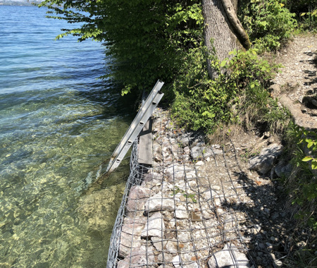
STEINSCHLAGTAFEL
Oostenrijk
Steinschlagtafel is especially interesting on the south side. The bottom is varied and consists partly of sand and rocks. There are no objects except for some branches, stumps and trees, entirely covered with mussels. From Steinschlagtafel the drop-off at Schwarze Brucke can be reached. It stretches from twenty meters untill five meters below the surface.
Particulars
Enter the water from the side and concentrate on the southern part of this site (left). On the north side the bottom is rather dull, with some scattered rocks and plants.
Warnings
No precautions for a dive at altitude required. Visibility may vary depending on wind and season.
STEINSCHLAGTAFEL Features
- Address
- Weyregg am Attersee, Oostenrijk
- Parking
- Sufficient parking
- Distance
- 50 m.
- Suitable for
- Experienced divers
- Permit
- N.v.t. / NA
- Access
- Free access
- Facilities
- Stairs
- Water
- Salt
- Tide
- N.v.t.
- Kind of dive
- Shore dive, mountain lake
- Current
- None
- Visibility
- 5 - 25 m.
- Average visibility
- 15 m.
- Depth
- 30 m.
- Bottom
- zand en modder
- Life
- Perch, eelpout, trout, eel, pike, roach, salmon
- Other recreation
- Holiday region with beautiful mountains and numerous recreational opportunities,
Current weather conditions
Spots nearby
 Liebensbrucke (0,56km)
 Schwarze brucke (0,69km)
 Ofen (0,82km)
 Twin towers (1,38km)
 Fottinger (1,40km)
 Dixi (1,55km)
 Schlierwand (1,91km)
 Alexenau (2,62km)
 Owr (2,88km)
 Steinwand (3,49km)
 Nussdorf hausboot (3,66km)
 Hinkelsteine (4,02km)


