JAMES BARRIE
Groot Brittanie
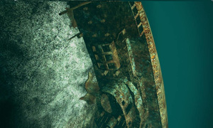
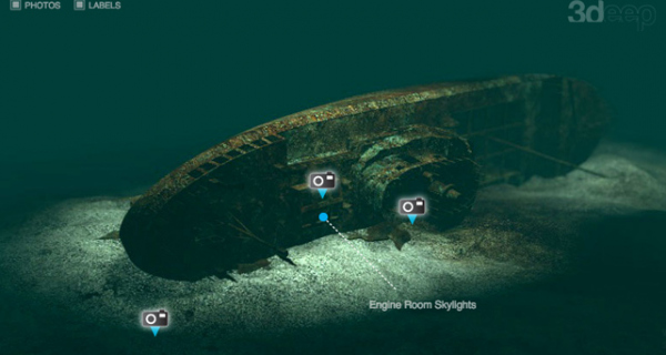
The James Barrie ran aground on Lother Rock, on the south-western end of South Ronaldsay on March 27th 1969. This caused a crack in the hull, after which it was decided to tow the ship to Scapa Flow. Fate decided otherwise. The ship sank on the way and is now on starboard side on a flat, rocky bottom, before the entrance of Wide Wall Bay. The James Barrie is still entirely intact, although many bronze parts have been removed. It is one of the southernmost wrecks in this area and a nice change from the large warships that make Scapa Flow so famous.
Particulars
Type: Fishing trawler. Length: 55m. Width: 9.3m. Weight: 666 tons. Builder: Lewis John & Sons Ltd, Aberdeen. Year built: 1949. Sunk: March 27, 1969. Deepest point: 43m.
Warnings
The James Barrie is located in fast-flowing tidal waters. On good days you have a dive window of approximately 40 minutes.
JAMES BARRIE Divemaps 1
- Divers Guide Map
- Detailed map
- Wreck map
- Local map
Distribution is illegal
JAMES BARRIE Features
- Nicknames
- Barrie, Benella
- Address
- Schotland, Orkney Isles, Scapa Flow
- Parking
- At boat charter
- Distance
- 30 min.
- Suitable for
- Groups, underwater photography, wreck divers
- Permit
- N.v.t.
- Access
- Free access
- Facilities
- Boat dive facilities
- Water
- Salt
- Kind of dive
- Boat dive, wreck dive
- Current
- Medium, strong
- Visibility
- 12 - 20 m.
- Average visibility
- 15 m.
- Depth
- 43 m.
- Bottom
- rotsen en stenen,zand
- Life
- Dead man's finger, grey seal , saithe, crab, lobster, wrasse, sea moss or bryozoan or sea-mat, moon jellyfish, polyp, comb jelly, whale shark, sea urchin, starfish
- Other recreation
- None
Current weather conditions
Spots nearby
 Yc21 en f2 (9,63km)
 Sms dresden (9,86km)
 Sms konig (10,42km)
 Sms cÖln (11,12km)
 Sms brummer (11,49km)
Read more


