GHALLIS ROCKS
Malta
0 Log Reports
Easy dive site
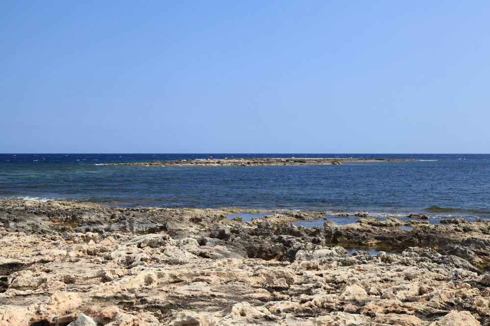
Ghallis Rocks is exposed but the dive site itself is sheltered from the northwest wind. It is an oddly shaped plateau that sticks into the sea from the mainland but still seems to be attached to it. The sea between Ghalis Rocks and the coast is very shallow but at the edges there are drop-offs to about 16 meters.
Particulars
Water from the coast and swim close to the islands on rocky landscapes full of cracks, small canals and large holes filled with pebbles and slippery stones. Further away, the rocks turn into a sandy bottom with meadows of eelgrass and boulders.
Warnings
Ghallis Rocks is a paradise for windsurfers. Respect each other. Beware of boat traffic and high waves in windy weather conditions.
GHALLIS ROCKS Features
- Nicknames
- Blata Tal-Ghallis
- Address
- Tul il-Kosta, Baħar iċ-Ċagħaq, Maghtab, Malta
- Parking
- Limited parking
- Distance
- 50 m.
- Suitable for
- All levels
- Permit
- N.v.t.
- Access
- Free access, rocky and sharp path., by shot line or anchor line
- Facilities
- None
- Water
- Salt
- Tide
- N.v.t.
- Kind of dive
- Reef dive , shallow dive, boat dive, shore dive
- Current
- Limited, variable
- Visibility
- 20 - 40 m.
- Average visibility
- 30 m.
- Depth
- 16 m.
- Bottom
- boulders,rocks,sand and seagrass
- Life
- Stingray, double banded bream, common octopus, european parrotfish, ornate- or turkish wrasse, saddled bream, mediterranean moray or roman eel, striped red mullet
- Other recreation
- Wind surfing
- Emergency
- 112
:
:
Current weather conditions
Wind :
Condition :
Temperature : °C
Powered by World Weather Online
Spots nearby
 Qawra reef (1,67km)
 Imperial eagle (1,75km)
 Qawra point north (1,96km)
 Lockheed p2v neptune (2,92km)
 H.m.s. stubborn (3,41km)
 Sirens (3,75km)
 St. pauls island inner reef (3,81km)
 Tuna farms (3,85km)
 St. pauls island outer reef (4,50km)
 H.m.s. kingston (4,51km)
 Bristol beaufighter (5,03km)
 Merkanti reef (5,52km)
Shops nearby
SAMOS DIVE CENTER Distance: 1.128,09km SUBLUB VOERENDAAL Distance: 1.793,47km XPLORE DIVING Distance: 1.816,65km LIMBURG DIVING Distance: 1.825,64km GALICIA TECHNICAL DIVING Distance: 1.840,82km
SCUBAREPAIR
Distance: 1.847,03km
DIVE COMPANY KEMPERVENNEN
Distance: 1.853,95km
BRABANT DIVING
Distance: 1.861,36km
SCUBA SHACK
Distance: 1.863,08km
DUIKCENTRUM EINDHOVEN
Distance: 1.868,48km
Read more
Lost something at this spot?